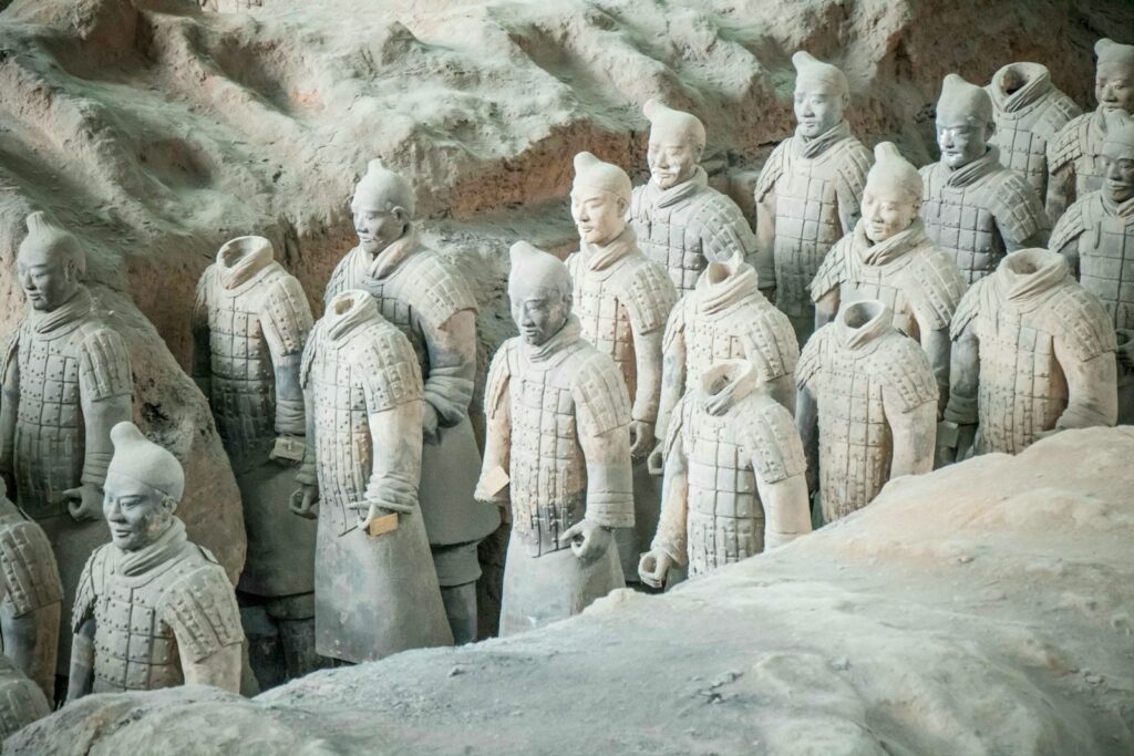
The field of archaeology has long been characterized by the romantic image of an intrepid explorer, brush in hand, painstakingly uncovering the secrets of the ancient world from beneath layers of earth and time. While the excitement of discovery remains a central theme, the methods by which these discoveries are made have undergone a dramatic transformation in recent years. The advent of new technological tools has not only accelerated archaeological research but also expanded the boundaries of what is possible, leading to the unearthing of previously undiscovered sites and offering groundbreaking insights into human history. This article explores how these cutting-edge technologies have revolutionized the field and highlights some of the remarkable findings they have facilitated.
Ground-Penetrating Radar (GPR)
Ground-penetrating radar (GPR) has become one of the most invaluable tools in the archaeologist’s toolkit. By emitting radar pulses into the ground and measuring the returned signals, GPR allows researchers to visualize what lies beneath the surface without the need for excavation. This non-invasive method is particularly useful in sensitive or inaccessible areas, where traditional digging methods are not feasible.
One of the most striking examples of GPR’s capabilities came with the discovery of a Viking ship burial in Norway. Buried just below the topsoil in a farmer’s field, the ship’s imprint was invisible on the surface but was clearly outlined in the GPR data. This find not only added to our understanding of Viking burial practices but also demonstrated how technology could reveal secrets hidden in plain sight.
LiDAR Technology
Light Detection and Ranging (LiDAR) technology has been a game-changer in the search for lost civilizations. Mounted on airplanes or drones, LiDAR sensors emit millions of laser pulses per second toward the ground. By measuring how long it takes for each pulse to bounce back, LiDAR creates detailed 3D maps of the Earth’s surface, penetrating dense vegetation to reveal the contours of ancient structures below.
A groundbreaking application of LiDAR technology was the discovery of a vast, ancient Maya city in the jungles of Guatemala. Hidden for centuries beneath a thick canopy of trees, the city’s network of plazas, roads, and pyramids came to light through LiDAR scans. This discovery has significantly altered our understanding of Maya civilization, suggesting it was far more complex and interconnected than previously believed.
3D Scanning and Printing
3D scanning and printing technologies have opened new avenues for the preservation and analysis of archaeological artifacts. High-resolution 3D scanners capture the precise shape and texture of objects, creating digital replicas that can be studied in detail or used to produce physical copies through 3D printing. This technology not only aids in the preservation of fragile artifacts but also allows for the sharing of replicas with researchers and the public around the world.
An illustrative case is the scanning of the Lioness of El-Hibeh in Egypt. The original limestone statue, dating back over 2,600 years, was subjected to vandalism but has been digitally preserved through 3D scanning. Researchers can now explore every detail of the statue’s craftsmanship digitally, while 3D-printed replicas make it accessible to a wider audience.
 Digital Archaeology and Virtual Reality
Digital archaeology, encompassing various computer-based analysis techniques, and virtual reality (VR) are transforming the way archaeological sites are studied and presented. These technologies enable the digital reconstruction of sites, allowing researchers and the public to virtually explore ancient worlds as they might have appeared in their prime.
A notable application of digital reconstruction and VR was the virtual rebirth of the ancient city of Palmyra in Syria, much of which was destroyed by ISIS. Using 3D models and photographs, researchers have created a virtual reality experience of Palmyra, allowing users to walk through the ancient streets and buildings, experiencing the site’s former glory.
Satellite Imagery
Satellite imagery has proven to be a powerful tool for archaeological surveying, enabling the identification of potential sites of interest from space. High-resolution images can reveal patterns or anomalies on the Earth’s surface that suggest human activity, even in remote or inaccessible regions.
One of the most significant finds made possible by satellite imagery is the identification of potential Neolithic structures in Saudi Arabia. From the vantage point of space, researchers spotted thousands of stone structures, dubbed “gates” due to their appearance, scattered across the desert landscape. These structures, believed to be up to 7,000 years old, had gone unnoticed until viewed from above, showcasing the potential of satellite technology to uncover new aspects of ancient human life.
Conclusion
The integration of new technological tools into archaeological research has profoundly expanded our understanding of the past. Groundbreaking discoveries, once the domain of manual labor and serendipity, are now increasingly the result of advanced technologies that allow us to see beneath the surface, penetrate dense jungles, and recreate lost worlds in digital form. As these technologies continue to evolve, the future of archaeology promises even more exciting discoveries, revealing untold stories of human history and deepening our connection to the ancient world. The marriage of technology and archaeology is not only transforming the field but also democratizing access to its findings, making the past more present and palpable than ever before.